Sanctuary Gorilla Forest Camp
October 7, 2026
How to Get to Zanzibar
October 7, 2026
The History of Serengeti National Park Tanzania
Most visitors arrive in the Serengeti national park Tanzania already knowing what they came to see: the migration, the lions, the endless grass horizon. Few arrive knowing why the park exists in its current form or how close it came to looking very different.
The Serengeti’s boundaries, its name, and even the fact that the wildebeest migration still moves freely across an open ecosystem today are all the result of specific decisions made across roughly a century by Maasai communities, colonial administrators, a determined German conservationist, and international bodies that eventually recognized what was at stake.
Understanding that history changes how the park feels once you are standing in it, because you start to see a managed landscape rather than untouched wilderness.
We think this matters for anyone planning a serious visit, not just as background trivia but as context that shapes what you will actually experience on the ground, from why the Ngorongoro Crater is administered separately from the park next door to why certain areas remain open to Maasai grazing while others are strictly protected. This is the factual story, told the way our guides tell it around a campfire once the game drives are done for the day.
Where the Name Serengeti Comes From
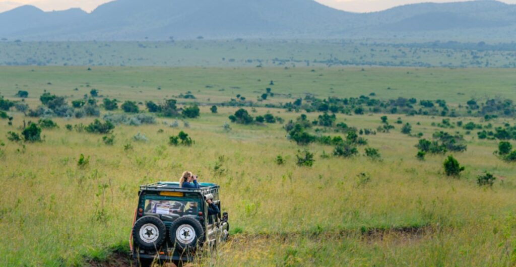
The word Serengeti is widely traced to the Maasai term siringet, generally translated as the place where the land runs on forever, or more loosely, endless plains. The description fits the geography with unusual precision. Standing anywhere in the central Serengeti, the grassland stretches to a flat horizon in every direction, broken only by scattered granite kopjes and the occasional acacia.
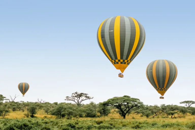
Long before any conservation boundary existed on a map, Maasai pastoralists had already named this landscape accurately, moving their cattle seasonally across it in rhythm with the same rains that now drive the wildebeest migration tourists travel across the world to see.
This detail matters for understanding the deeper history here. The Serengeti was never an empty wilderness discovered by outsiders. It was, and in the surrounding Ngorongoro Conservation Area still is, a landscape actively used and understood by the Maasai for generations before it became a protected area, and that prior relationship shaped many of the decisions made once colonial and later Tanzanian authorities began drawing formal boundaries.
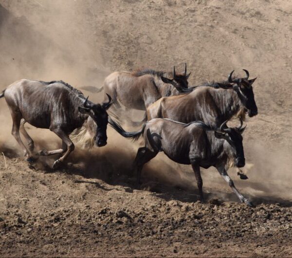
Wildebeest Migration
The Colonial Era and the First Protections
Formal protection of the Serengeti began under British colonial administration in the early twentieth century, initially motivated less by ecological philosophy than by concern over declining lion and other game populations from unregulated hunting.
A partial game reserve was established in the 1920s covering a section of the plains, and by 1930 the British colonial administrator Major Richard Hingston had formally proposed upgrading the Serengeti Game Reserve toward full national park status, recognising that hunting pressure and encroaching development threatened to permanently damage the ecosystem.
That proposal took a decade to become reality. The Serengeti was declared a national park in 1940, though the boundaries and legal protections were not fully settled at that point. It took further work through the 1940s, including the formation of the Serengeti National Park Board of Trustees in 1948, before the park’s borders were formally finalised in 1951 and enforcement infrastructure, ranger patrols, boundary markers, and basic administration began to take shape.
This slow, incremental process is worth noting because it explains why the Serengeti’s early conservation history reads more like a gradual tightening of protections than a single decisive founding moment.
The 1959 Split: Ngorongoro Conservation Area
One of the most consequential decisions in the park’s history came in 1959, when colonial authorities separated a large eastern portion of the original protected area, roughly 8,300 square kilometers including the Ngorongoro Crater, and redesignated it as the Ngorongoro Conservation Area rather than part of the strictly protected national park.
The stated purpose was to accommodate Maasai land use interests within a multiple use framework, allowing pastoralist grazing to continue alongside wildlife conservation in a way the stricter national park designation would not have permitted.
This decision still shapes safari planning today. It is the direct reason Ngorongoro operates under different rules than the Serengeti next door, why you will see Maasai cattle herds grazing near the crater rim on the drive in, and why entry fees and park administration for Ngorongoro are handled separately from Serengeti National Park proper. Travellers often assume the two are simply neighbouring national parks with a shared boundary line.
The truth is more specific: they are two different conservation categories, created through a negotiated compromise over land rights that dates back more than sixty years and remains a live policy topic in Tanzania today.
Bernhard Grzimek and the Fight to Save the Migration
By the 1950s, despite formal protection, the Serengeti faced a genuine threat that had nothing to do with hunting. Colonial administrators were considering shrinking the park’s boundaries to accommodate agricultural development and the resettlement pressures of the era, a move that would have cut the migration off from crucial dry season grazing areas outside the original protected zone.
A German zoologist and conservationist named Bernhard Grzimek, working with his son Michael, undertook an aerial survey of the migration’s actual movement patterns using a small plane, the first serious scientific attempt to map where the wildebeest and zebra herds travelled across the seasons.
Their findings became the basis of the 1959 book and documentary film both titled Serengeti Shall Not Die, which argued, with hard survey data behind it, that any reduction in the park’s boundaries would sever the ecosystem the migration depended on.
The film won international recognition, including an Academy Award, and is widely credited with shifting global public and political opinion toward preserving the Serengeti’s full migratory range rather than a reduced, static reserve.
Michael Grzimek died in a plane crash during the survey work in 1959, and is buried on the rim of the Ngorongoro Crater, a detail many guides point out to guests who ask about the crater’s history.
The practical result of the Grzimeks’ work is something every visitor benefits from today. Because the boundaries were defended rather than reduced, the Serengeti ecosystem remains large and connected enough for the migration to still function as a genuine, unbroken cycle rather than a fragmented remnant confined to a single fenced area, which is what happened to migratory wildlife populations in many other parts of the world during the same period.
Independence, Tanzanian Stewardship and Expanding Protection
Tanzania gained independence in 1961, and the newly formed Tanzanian government inherited the Serengeti as a national asset rather than a colonial holding. Tanzania’s first president, Julius Nyerere, is closely associated with a strong national conservation ethic, formalised in the 1961 Arusha Manifesto, a public declaration committing the young nation to protecting its wildlife heritage as both an ecological and economic priority.
That commitment shaped decades of Tanzanian park policy afterward, and it is part of why the country’s national parks system, Tanzania National Parks Authority, remains one of the more consistently protected networks on the continent.
Nyerere’s legacy also explains the naming of Nyerere National Park, formerly the southern portion of the Selous Game Reserve, gazetted under his name in 2019 as a tribute to his role in Tanzanian conservation policy. Travellers researching the country’s parks will encounter his name in more than one context, and it consistently traces back to this same period of early independence conservation commitment.
UNESCO World Heritage Status
In 1981, UNESCO formally inscribed Serengeti National Park as a Natural World Heritage Site, recognising both its exceptional wildlife populations and the ecological significance of the migration itself as a globally unique natural phenomenon.
The designation carries practical weight beyond prestige. It commits Tanzania to specific conservation standards and reporting obligations, and it has helped attract international conservation funding and research partnerships that continue to inform how the park is managed today, from anti poaching enforcement to long term ecological monitoring of the migration’s health.
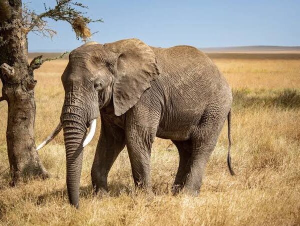
Elephant in Serengeti national park
The Serengeti was also designated a UNESCO Biosphere Reserve in 1981, a related but distinct classification that recognises the broader ecosystem, including areas used for sustainable human activity around the park’s edges, alongside the strictly protected core.
Key Milestones at a Glance
| Year | Event |
| 1920s | Initial partial game reserve established under British colonial administration |
| 1930 | Major Richard Hingston proposes national park status to protect the ecosystem |
| 1940 | Serengeti formally declared a national park |
| 1948 | Serengeti National Park Board of Trustees formed |
| 1951 | Park boundaries formally finalised and enforcement strengthened |
| 1959 | Ngorongoro Conservation Area separated from the park; Grzimeks’ aerial migration survey and Serengeti Shall Not Die released |
| 1961 | Tanzanian independence; Arusha Manifesto commits the nation to wildlife conservation |
| 1981 | UNESCO World Heritage Site and Biosphere Reserve designation |
| 2019 | Nyerere National Park gazetted from the former Selous Game Reserve, honouring Julius Nyerere |
How This History Shapes the Park Experience Today
The migration you see today, an estimated 1.5 million wildebeest moving alongside roughly 250,000 zebra and several hundred thousand gazelle across an unbroken 800-kilometer annual route, exists in its current form specifically because the ecosystem was kept whole rather than fragmented.
If the 1950s boundary reduction proposals had gone ahead, the herds would likely be cut off from critical dry season grazing, and the scale of what you witness on a July river crossing or a February calving season would look fundamentally different, smaller, more constrained, less predictable.
The Ngorongoro and Serengeti administrative split also explains a practical planning detail many guests only learn once they arrive. Entry fees, permits and vehicle rules differ between the two areas because they are legally distinct conservation categories, not because of arbitrary bureaucracy. Understanding this in advance helps when budgeting a combined Serengeti and Ngorongoro itinerary, since you are effectively paying for entry into two separately administered systems rather than one continuous park.
Finally, the Maasai relationship with this land, older than any of the formal protections layered on top of it, remains visible today in the Ngorongoro Conservation Area’s grazing rights and in cultural village visits offered alongside game drives in the region.
This is not a historical footnote. It is an active, ongoing arrangement that continues to be negotiated and debated in Tanzanian policy circles, and travellers who take a genuine interest in it tend to come away with a noticeably deeper understanding of the region than those who treat the visit purely as a wildlife checklist.
Frequently Asked Questions
Is Ngorongoro Crater part of Serengeti National Park?
No. Ngorongoro Conservation Area was separated from the Serengeti in 1959 and is administered under a different multiple land use designation that permits Maasai grazing. The two are adjacent and commonly visited together, but they operate under separate management and fee structures.
Who is credited with saving the Serengeti migration?
Bernhard Grzimek and his son Michael are the figures most closely associated with defending the park’s boundaries in the late 1950s, through aerial survey work and the influential book and film Serengeti Shall Not Die, which helped prevent proposed boundary reductions that would have disrupted the migration route.
When did the Serengeti become a UNESCO World Heritage Site?
1981, the same year it was also designated a UNESCO Biosphere Reserve, recognising both the exceptional wildlife populations and the ecological significance of the migration.
Do Maasai communities still live in or near the Serengeti?
Maasai communities are not permitted to graze livestock inside Serengeti National Park itself, but they retain grazing rights in the neighbouring Ngorongoro Conservation Area, a direct legacy of the 1959 boundary decision, and remain an active cultural presence throughout the wider region.
How old is Serengeti National Park?
The park was declared in 1940 and had its boundaries formally finalised by 1951, making it one of Africa’s older continuously protected national parks, with a management history now spanning more than eight decades.
Visiting with the History in Mind
Knowing this history does not change the wildlife you will see on a Serengeti game drive, but it changes how you understand what you are looking at. The open, unbroken plains that make the migration possible were deliberately preserved rather than inevitable, defended by specific people making specific decisions across a difficult century. That context tends to deepen the experience for travellers who take the time to understand it, and our guides are always glad to walk through this background in more detail once you are on the ground.